Edobashi Crosslink Plaza
A station becomes part of everyday life.
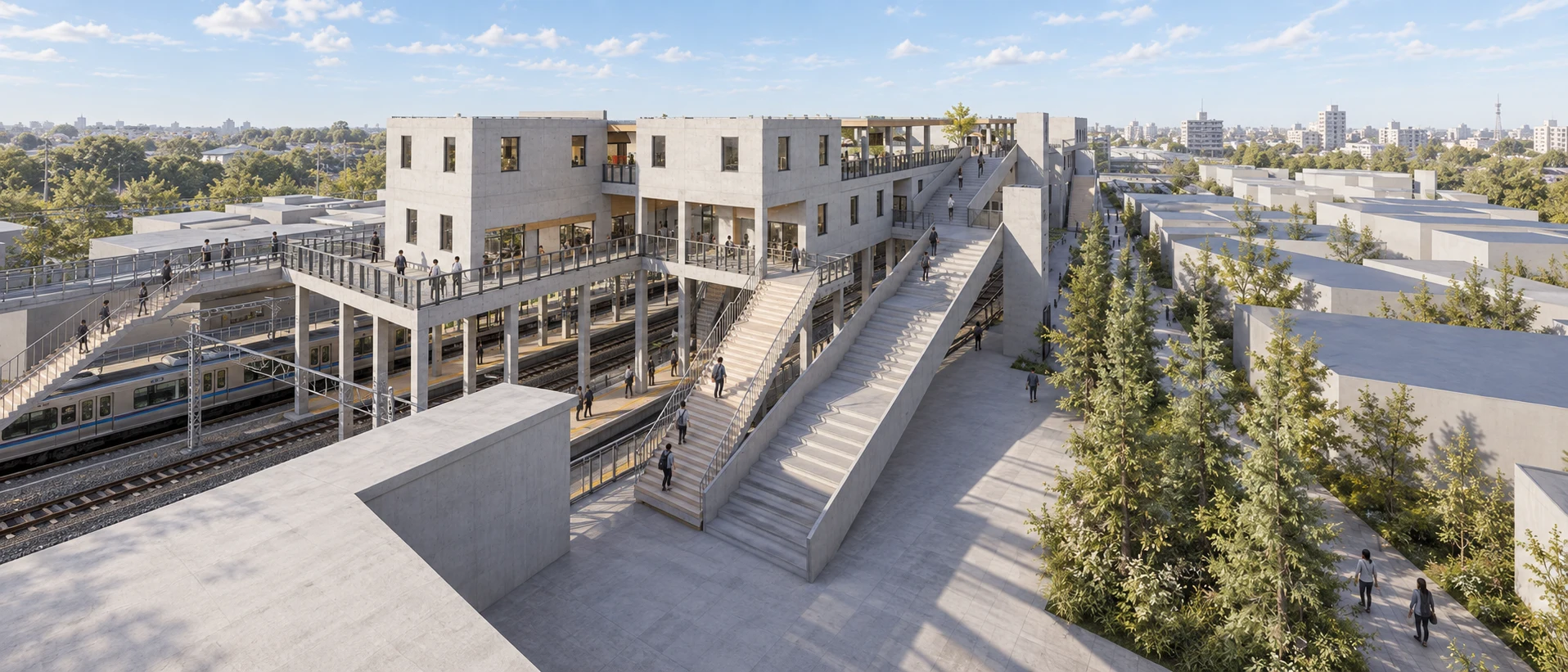
An existing railway station becomes the starting point for a connected public place, bringing transport, shared routes and daily services into closer relation.
Begin with the existing station
The railway, platforms and surrounding urban blocks are the starting conditions for the design. Site observations record the existing entrance, bicycle access and rail crossing. These ordinary arrival conditions are central to understanding how commuters, students, residents and visitors reach the station.
The surrounding streets, rail alignment and station entrances establish the project’s starting conditions. A site map and the original observations can be read alongside the proposal without confusing the existing station with the redevelopment.
Original site observations
Entrance photograph ↗ · Bicycle approach ↗ · Rail crossing ↗
Layering movement and activity
Elevated connections and terraces organize movement through the redevelopment. The second level combines restaurants, workspaces, a bookshop and station services. The third adds retail, play, performance, shared seating and terrace space.
The longitudinal section is essential to the proposal: it explains how the railway and station level sit beneath a connected sequence of public and commercial floors. Reading the plans together with this section makes the layered organization legible.
From station volume to shared routes
The massing studies break the proposal into occupied layers and the connections between them. Commercial and civic uses sit above the railway, while bridges, stairs and terraces turn the change in level into a visible part of the architecture.
Read these diagrams against the floor plans: the ground establishes arrival, the middle layer combines daily services and work, and the upper layer creates further opportunities for leisure and gathering. The diagrams explain the proposal’s organization; the drawings locate its rooms and routes.
A reason to stay
The lower-level dining court introduces food kiosks, shared tables and planted edges alongside the station. It gives the route a place to pause, turning a movement corridor into a setting for meeting, eating and everyday use.
The project connects site analysis, multilevel planning and physical-model communication. It explores how an intervention can build on existing conditions while creating a broader public role for transport architecture.
The public edge, in elevation
The elevations describe the rhythm of the supported floors, openings and large external stair. Together with the section, they show how the building presents its circulation to the surrounding neighbourhood.
The proposal’s identity comes from this relationship between occupied levels and accessible public space. The floor plans and vertical routes remain the primary references for understanding how the scheme is organized.
The station in its neighbourhood
The physical model brings the railway, surrounding blocks and proposed public spaces into one view. The blue context volumes make the station’s position within the neighbourhood clear, while the timber-coloured roofs distinguish the intervention.
Read the long stair, elevated connections and planted plaza together: they connect the building’s different levels to the surrounding streets. This overall view complements the floor plans and sections by showing the proposal as part of the whole site.